
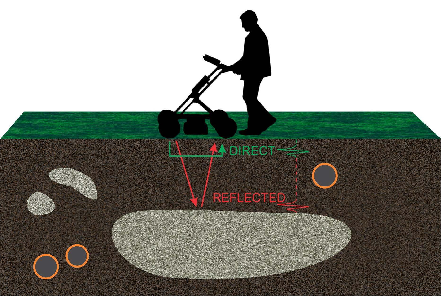
Ground Penetrating Radar (GPR) is a non-invasive technique. GPR works by sending radio waves (electromagnetic energy) down through the ground using two antennas that send and receive the waves. When passing through the ground, any change in the physical material of the ground, such as a change from clay to sand, or an area of disturbance (an “anomaly”) will be identifiable with this technology. Information on these reflections is recorded by the GPR unit using an onboard computer. These reflected signals produce a scanned image of the underground.

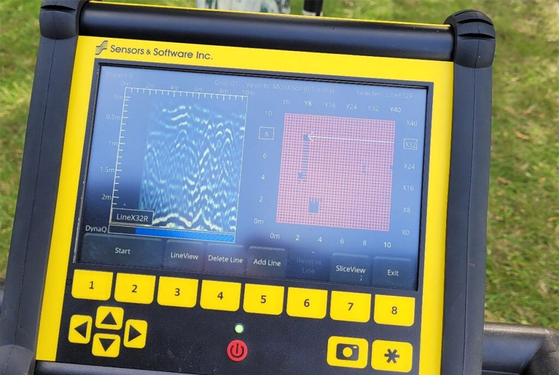
Through mapping data and community input, archaeologists can determine which lands should be sectioned off and minimally cleared to apply the technology. A GPR machine has a power supply, an antenna, and a control unit. The operator pushes the GPR machine in a carefully set up grid pattern across the area. The control unit runs software that shows the scanned image of received signals. The GPR technician will read and interpret the images to determine if there are any areas of interest or anomalies consistent with grave dimensions, and rule out anomalies that do not fit the description.
GPR should only be used to support or verify Indigenous knowledge, historical information, or other data (such as surface features or anomalies). Generally, the more information community members are able to share, the |better the GPR operators are able to target specific areas and return meaningful results.
Ground Penetrating Radar (GPR) is a “non-invasive” survey method, meaning it doesn’t disturb the land. There’s no digging, and the surface stays untouched. In warmer months, the GPR device is mounted on a wheeled cart and pushed across the ground. In winter, it’s attached to a sled and pulled over the snow by a snowmobile.
The key to ensuring that the ground search is as thorough as possible, it is important to include information from a range of different sources, including Survivors’ stories, archival records, mapping, and non-invasive ground search data.
The purpose of the ground search is to locate physical evidence of anomalies that may indicate the presence of burials. This is a process that includes different sources of information to identify locations of interest in the ground search. A non-invasive ground search does not disturb the soil. This information was summarized from several sources listed at the end if you would like further information.
A Ground Penetrating Radar (GPR) works like a fish finder, but for land instead of water. It sends radio waves into the ground, and some of the energy bounces back when it hits something underground. Different materials reflect the energy in different ways. Bright spots in the GPR data mean the material reflects a lot of energy, while dark spots mean it reflects less. These bright and dark areas help show what’s underground.
GPR is best at finding differences in the ground. For example, if a burial shaft was dug, it would disturb the natural layers of soil, creating a pattern that stands out. Soil that was dug up and replaced never goes back exactly as it was before, and this disruption shows up in GPR data.
However, if the ground has been heavily disturbed by building foundations, digging, or heavy machinery, it mixes up the layers. In these cases, it’s much harder for GPR to detect unmarked burials because the natural patterns are already broken.
A Ground Penetrating Radar (GPR) survey is done entirely from the surface and doesn’t disturb the ground. It won’t uncover bones or objects but collects information about what’s underground.
The hardest part of using GPR is understanding the data it collects. It can detect differences underground, like the size, shape, and location of objects, but it doesn’t give a clear picture. Many things, both natural and man-made, can look suggests similar to unmarked graves.
To identify unmarked graves, experts look for patterns that are unlikely to happen by chance. Graves are usually rectangular, about 1 to 2 meters long, spaced evenly apart, and may line up in the same direction. If these patterns are found, it suggests unmarked graves might be present.
Finding these patterns is complex. Data from the GPR needs to be processed and analyzed using special computer tools after the survey. This takes time—sometimes weeks—depending on how much data was collected. It’s normal not to have answers immediately after the survey.
If the survey is successful, the GPR report will include maps of the burial grounds, descriptions of graves based on GPR profiles (such as number, depth, etc.), a specific evaluation of the area to assess whether disturbance could be an issue, and potential recommendations aligned with community-defined goals, such as determining the appropriate size for a fence on the site area.
Benefits of GPR
GPR is the most widely used method and has a high success rate in locating potential unmarked graves with fast results. GPR works well for cemeteries and accurately locating the depth of individual burials over small areas.
Limitations of GPR
GPR heavily relies on knowledge of the area, or else its advantages and use are limited. This method has difficulties in covering large areas, and does not work as well in areas with rough terrain, dense tree coverage, or water-logged soils. It is also not an x-ray machine, and cannot describe what those changes (anomalies) are outside of their size/dimension. The data produced by the GPR also requires a specifically trained technician to read the data and interpret it correctly.
Photogrammetry is a technique that ‘stitches together’ high resolution photographs, taken either with a drone or via satellite (used for larger areas), to determine where searches should occur, ground characteristics, topography of the land, and precise measurements. Using historical photos, this technique can show the location of features no longer present on the ground.
LiDAR is a technique that uses ultraviolet, visible or near-infrared light to gather surface data regardless of cloud, forest, or building cover. LiDAR data is collected by drones to produce a mapping model that describes the surface and its elevation (known as a digital terrain model). LiDAR works well for collecting data over large areas and can be used regardless of season.
Photogrammetry and LiDAR are compared together in a software called ArcGIS to create contours around depressions where graves may have been dug. Both methods are great for identifying areas of interest but cannot detect underground graves as GPR can.
Benefits of lidar
LiDAR can cover areas of interest much faster and efficiently even in rough environments with many trees, rocks, and even underwater.
Limitations of lidar
LiDAR does not show the areas deep underground and may lack detail in the image depending on the type of light beam used. Technology must be done in weather that is non-foggy to create clear images.
Risks of Geophysical Survey Methods
The risks for geophysical survey methods are low. Searches can be done without disturbance to the ground or graves, beyond minimal removal of brush deemed necessary by an archaeologist. Risks may include re-traumatization or triggers for community members.
Ground-penetrating radar (GPR) is a non-invasive tool used to detect differences beneath the ground surface by sending radio-wave pulses into the earth. Most of this energy fades away, but some reflects back when it hits materials with different properties (density, moisture, or composition). These reflected signals show the variations underground - referred to as anomalies. Ultimately, GPR helps identify where something is different, but not what it is. Further analysis of its size, shape, extent, and patterning with other features is needed to confirm the likely nature of an anomaly.
What are "anomalies"?
Anomalies are simply differences in the underground environment compared to the surrounding soil. GPR does not reveal what the object is - only that something is different. This neutral, objective term allows us to:
- Avoid assumptions (e.g., prematurely calling something a grave)
- Remain scientifically accurate
- Communicate respectfully with communities
why not call them graves?
Not all anomalies are unmarked burials. They may be:
- Natural features (tree roots, animal tunnels, rocks, varied soil layers)
- Man-made disturbances (pipes, old construction)
- Or potential burial sites that require further investigation
Expert interpretation is critical. Analysts look for patterns that suggest human activity - especially unmarked graves. These include:
burial-like anomalies:
- Rectangular or oval shapes, 1–2 meters long
- Well-defined edges, more than twice as long as wide
- Consistent size and alignment across multiple anomalies
- Disturbances of natural soil layering with different moisture and compaction
contrasting natual features
Irregular or organic shapes, Random distribution, Gradual changes in soil density or water content, poorly defined edges.